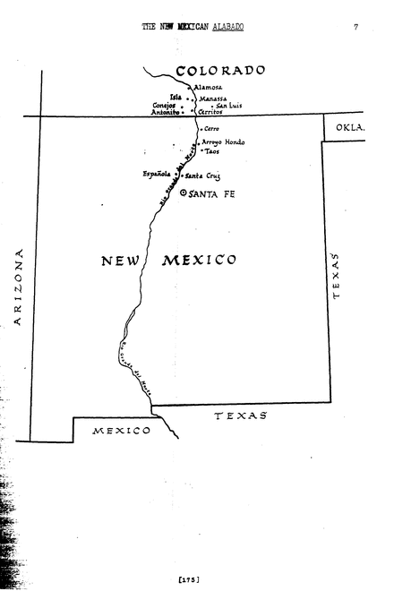
Map of the Rio Grande River valley in New Mexico and Colorado
Dublin Core
Title
Map of the Rio Grande River valley in New Mexico and Colorado
Subject
Maps
Description
This is a map that shows the entirety of the state of New Mexico and the bottom of Colorado. It illustrates where the Rio Grande river is and lists major cities near the northern part of New Mexico and the southern part of Colorado.
Creator
Rael, Juan Bautista (Author)
Source
- Source: The New Mexican Alabado by Juan B. Rael
- Reproduced with the permission of Stanford University Press
- Reproduced with the permission of Stanford University Press
Publisher
American Folklife Center
Date
1951
Rights
The Library of Congress is not aware of any U.S. copyright protection
Identifier
https://www.loc.gov/resource/afc1940002.afc1940002_map001/
Still Image Item Type Metadata
Original Format
Map
Citation
Rael, Juan Bautista (Author), “Map of the Rio Grande River valley in New Mexico and Colorado,” HIST 390 The Digital Past: A Cultural New Deal, accessed September 19, 2026, https://jessicadoeshistory.com/cnd/items/show/125.