
Mapping and spatial history can tell us a lot about the past. Old roads that no longer exist, or towns that exist now but live where a forest once was brings historians to ask the question; why? Why is this road abandoned but not another one? Why did people choose this specific place to build a town and not a place a few miles away? Answering these questions gives us a deeper look into history and the decisions that led to the present day. The map I made was from Boston, MA to Tiverton, RI. This map is very specific to me because it actually goes through my hometown, Easton Massachusetts, and through a lot of towns I grew up around. I was surprised to see Easton on the route because I don’t consider it a very well known town, but it definitely adds a more personal element to my map and I was able to use a picture my mom had taken which I thought was a great addition. Reading through the guide about the towns around Easton, I was surprised at how little things had changed. Sharon still doesn’t have much and is more of a rich residential area, Blue Hills is still a beautiful hiking spot that but now they also have an animal sanctuary which include river otters, and Easton’s public library.Seeing how little things have changed there since the 1930’s was a little surprising, but I feel like I should’ve expected it since they’re very quiet towns and not much happens there. Washington officials wanted to guidebooks to be composed in exactly the same way, but some state directors rebelled, and one of those was Ray Allen Billington from Massachusetts who argued against the strict essays they were expected to write and instead wrote his own 1. When reading over what was actually written in the guide books, it’s not easy to tell to me, but maybe if someone was reading a lot of the guidebooks, it would stick out more.
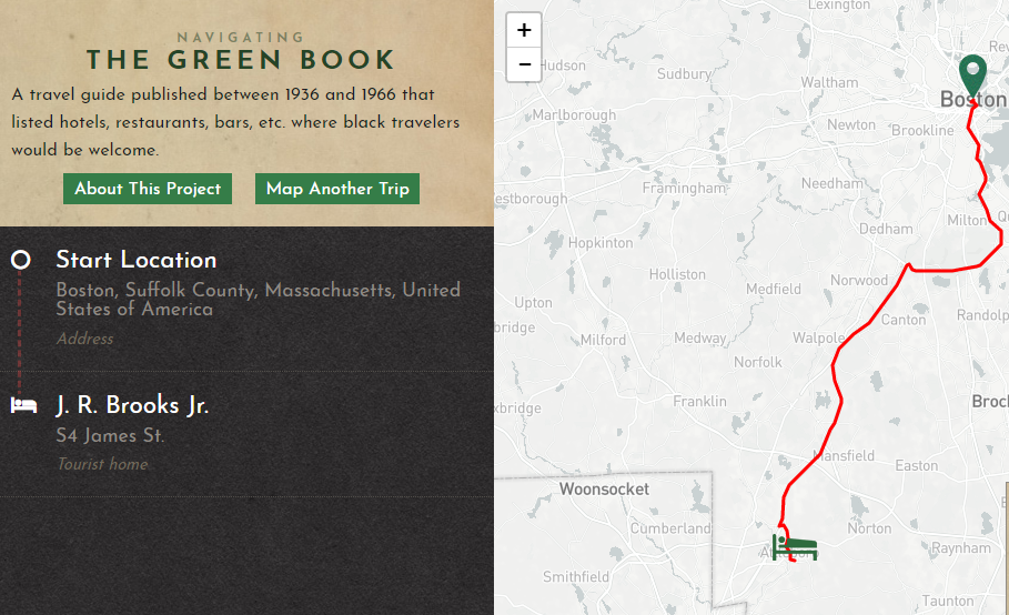
When I looked at the trip through the Green Book map, it looked very different. There was only one rest stop for black travelers between the starting point and ending point, and when looking at the heat map, there were barely any in the area. It’s also the closest stop to Rhode Island, because there were no stops for black travelers at all in RI. Considering how many cultures and how diverse Rhode Island, and especially Providence, is today this isn’t a result I was expecting. The black travelers that would be taking this trip wouldn’t be able to stay where they wanted to go, they wouldn’t have many places to stay at all throughout the trip, and it would be a long way before they could even stop. This map helps highlight the racism that was prevalent at the time and can help the public better understand the history of racism and slavery 2. Not having a place to stay meant that not a lot of black people could explore America like their white counterparts, which meant that they couldn’t experience America like the guidebooks wanted Americans to be able to.
- Shaffer, Marguerite. “Narrating the Nation.” See America First: Tourism and National Identity, 1880-1940, Smithsonian Institution, 2002
- Mapping Racism And Assessing the Success of the Digital Humanities https://sarahemilybond.com/2017/10/20/mapping-racism-and-assessing-the-success-of-the-digital-humanities/. The idea of mapping the history of racism and slavery has been around for a long time and this article helps explain why it’s important to not only historians but to everyday people. The move to digital projects as the medium for this only helps make this information more accessible to the public and to make it easier to understand the difficulties a lot of black people went through in their daily life, and how those still affect our society today.
