Impact of segregation on tourism

When creating my own map related to the American Guide Series, I chose to create my Map centered on Virginia, particularly in the Gainesville area because it’s where i’m from. The “Virginia: A guide to the Old Dominion- Tour 4a” 1, focuses on the town of Gainesville all the way to Front Royal, with stops in the Shenandoah Valley.

There’s an extensive list of stops that can be made when traveling through this area, and this is one of the tours that’s considered short in the Virginia guide series. In comparison to the Navigating the Green Book map, which shows little to no areas for stopping in both 1947 & 1956.

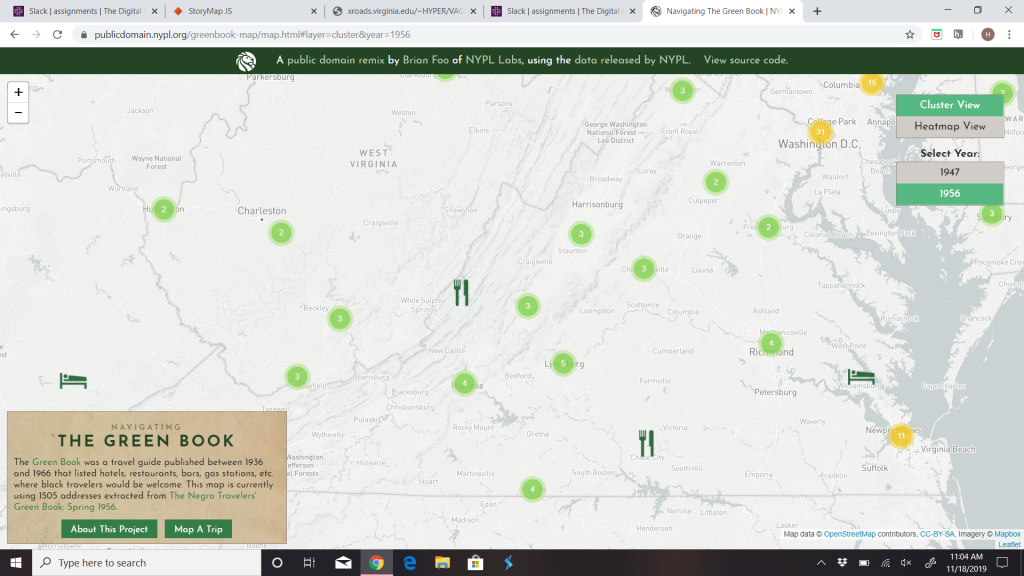
1947 Map
1956 Map

Virginia as a whole had no stops for African Americans at all in 1947, demonstrating a vast difference in the tourism experience for white people and black people in 1947 and in the 1900’s in general. There’s only one stop for black people that was added in Northern Virginia in 1956 and that’s at a hotel in Warrenton, where as there’s references and descriptions of multiple lodges and hotels in the Tour 4a stop descriptions.

As described in this exhibit by Utah State University, “the American Guide Series was a successful contribution to American culture and literature” 2. This is true, but only for those “Americans” who had the privilege of traveling to the locations mentioned in the guide series without segregation limiting them. Aside from that point, analyzing the maps also made me think about how mapping is able to display different inequalities in history. For example, in our class discussion concerning mapping, we were able to analyze redlining in America through the mapping inequality project 3. This further enforces and demonstrates to me as someone analyzing history and mapping, that a lot of history is described in beautiful sort of flowery language and glazes over how differently people of the time experienced that “history” depending on the color of their skin, class differences, gender, etc..
Blog 7

According to the guide book Vermont was originally comprised primarily English settlers. This racial and cultural homogeneity persisted well into the 20th century because there were no major manufacturing centers in the states. This ensured that there was little to no foreign immigration to the state. As quarry towns began to pop up there was a slow trickle of “Poles, Czechs, and Russians… Austrians and Swedes. ” (51) There was also a predominate number of Scottish, Italian and Welsh people. Interestingly a majority of immigrants either settle in after leaving nearby New Hampshire or were a part of the significant French-Canadian population.

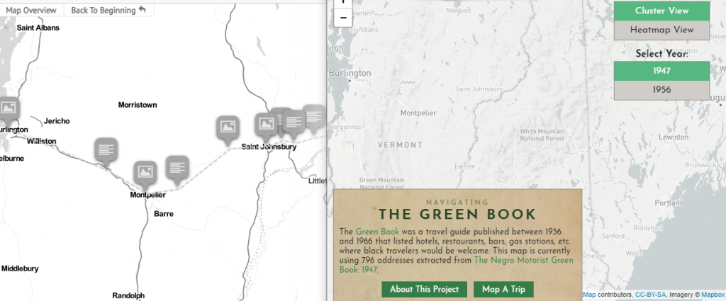
Having read all of this information before looking at the Green Book travel guide, I already new traveling in the area would have been extremely limited if not completely unavailable to Black people. I was of sadly, correct in my estimation. There was no route in the state of Vermont and much of New England was unavailable as well.

Although the guide books where essentially well received and bolstered tourism within the United States, and helped to underscore “states’ diversity and natural landscape”4 they also perpetuated a false narrative about who was included in that idea of America. These guide books, although generally informative and interesting to read can only fully be navigated by white or white passing men and their families.

In mapping my route as I was reading the descriptions of the different locals I was very particular about which stops I would be willing to make. I was unwilling to chose destinations that seem like they might be too secluded because as a woman traveler it would be a safety risk. Likewise I also avoided selecting towns like Danville, VT where there seemed to have been a strong confederate presence, or a great number of sympathizers. I was constantly aware of how I, as a Black woman would have been forced to navigate spaces that likely would have been hostile and unsafe.

It is particularly bizarre to think about the violence that might have been visited upon me because I have actually taken this trip. This juxtaposition is particularly poignant as I ponder how I would have fared 70 years ago. My race and gender would have informed every choice I was able to make in the public sphere.

The Green Book mapping project and others like it do a phenomenal job of illustrating the spacial impacts of racism. When this sort of information is rendered as a map, it allows for a greater depth of understanding. Being able to “geolocate social justice movements, visualize both historical and present racism and highlight racial issues”5 is essential to examining narratives about the past and who was allowed to be American, and understanding injustices as they occur in the present.

My guide

Mapping and Spatial History — Skill 6, Blog 7

I feel like I learned a lot from this exercise. Originally, I misread the instructions, and set about making a detailed tour map of Norfolk, VA—my hometown—based on the locations recommended by the page that focused on the city. I quickly learned that the locations were too close together to make a good map, and scrapped that project upon rereading the directions. However, it was really unique to be able to engage with my town’s history. I realized that at the time when the chapter was written, half the city’s suburbs had not even been built yet, as the majority of residential housing further away from the downtown area remained farmland until after World War II, when there was a huge housing boom upon the soldiers’ return from war. 

Instead of mapping Norfolk, I decided to follow Tour 7a. This spans from Virginia Beach, Va, through to Emporia, which is near the border to North Carolina. Although I have never followed the specific tour suggestions, the route from Norfolk, VA to Emporia is a familiar one to me, as it is a decent manner of navigating into both North Carolina and Tennessee. I feel like mapping this tour gave me new insight into history that I once drove through every day. This mapping exercise has really helped me engage with the history of the region I grew up in, and to form a better understanding of where everything is spatially speaking. The primary sources were really insightful—especially the one which focused on Norfolk. A lot of what was said back then rang true for today as well. There are still mansions on the Lafayette river, working class neighborhoods remain worse-off. The class divide in Norfolk is in many ways still as evident as it was when the tour was designed in 1939, and there are still radicalized connotations to that divide despite the end of segregation. Reading through these write-ups was a truly eye opening experience for me in terms of understanding the problems, not just the successes, of a city I spent the majority of my life living in.

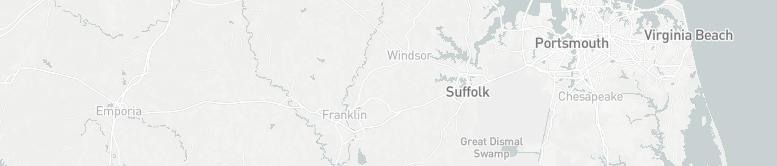
These problems were further brought to light when I looked at the Navigating the Green Book project maps from 1947. There were tons of points and heat map swaths of color all over the country—but Virginia and North Carolina were a dead zone. I cannot help but conclude that there was just cause for this blank space. These travel guides were designed for black travelers during the height of segregation, and being a predominantly rural southern region, the locations along the tour I chose to map were surely less than ideal. As pleasant as the white chroniclers make the sleepy little towns and bustling military cities seem, they were only pleasant for a select group. The sights to see might well be equally enjoyable for white and black travelers alike (Confederate statues excluded), but surely finding lodging, places to eat, places to refuel, etc would have been ten times as difficult for black automobile travelers. I think for that reason, the map screenshot I took is blank. It’s a stark reminder that even today, the beauty of the south and the ambience of small town life mask the darker past that built them. And it deserves to pointed out, criticized, and admonished. 

https://uploads.knightlab.com/storymapjs/d56ebb3e141bb0edb0e2e2f71608f8f4/virginia-beach-to-emporia-a-tour-of-virginias-historic-southeast/index.html

Workers of the Writers’ Program of the Work Projects Administration in the State of Virginia. “Tour 7a.” Virginia: a Guide to the Old Dominion, Oxford University Press, 1947.

“NavigatingThe Green Book.” Navigating The Green Book, publicdomain.nypl.org/greenbook-map/index.html.

Mapping Massachusetts: The American Guide Series

This project informed me mostly of the ability to see the intricacies of the past. Little stories that the American Guide Series authors chose to include and some bigger stories that I never knew has such a great effect on the rest of the state or country. I was very intrigued to know more about Massachusetts. I picked the state simply because I knew it had a deep history and that there are still many things to see there. Even though I picked a region of Massachusetts that was largely residential, it still presented crucial implications about the state. Also, I really loved to see how many of the artifacts that I found still exist today. To me, the 1930s were a completely different time than 2019 in many ways so, it’s very interesting to see how they’ve remained successful, changed shape, and still apply today. Spatial mapping can show us the frequencies of what people considered interesting in the 1930s. The creators of each guide were specific in what they chose each time to include. If they were trying to be as accurate as possible,

6

I wonder if there are any things that they didn’t include that are now successful that may have just been starting when they created the guide? 

Against my Green Book map, there were no locations on their map in the area I was studying. Instead of trying to make something show up, I felt like this showed more than a different map could. I did not think of the demographic that was living in the residential area of Massachusetts as any specific race but, its apparent that it was largely white if there were no safe places for black people just a couple of years later. All of the stories I learned and were so interested in had suddenly turned grey in my mind because all people couldn’t take part in them.

7

In a racially unwelcoming place, the past became clearer than before because now I could see not only the stories that happened but the people that got to tell them. To be clear, I still like the artifacts I found and the implications of industrialism in the surrounding areas but now, there’s a new vision of what the towns looked like and how it treated others.

Blog #7

When I visited Los Angeles two years ago I did not expect to see the bizarre car-culture frenzy that I did. A monstrosity urban sprawl, coupled with inadequate public transit, made it almost impossible to get anywhere without a car. I selected the Los Angeles Guide because I was interested to see whether the private ownership of a car had always impacted tourism and the ability to move through space in LA. Although the Guide notes railroad stations, bus stations, services, and streetcars, in the general information section of the book, it does not make any reference to them throughout the tours. The Guide assumes that the audience owns an automobile and this implies multiple things. The first is that Guide seems to be created for an affluent audience who owns automobiles and has the time for leisure activities. This is reaffirmed by the landmarks that Tour 6 focuses on, such as a mineral spring, multiple camp sites, and private beaches. But more importantly, the assumption that the audience owns a car also implies that makers of the Guide knew that cars would play a significant role in America’s future. They even note that “the Los Angeles of the future is likely to evolve along highways.” 8

Similar to most other things we have learned about in this class, maps do not offer an inherently impartial and “objective” perspective on history. It’s easy to forget that maps are also manmade and subject to the bias of the creator. Power and privilege must be taken into consideration when using maps and analyzing spatial history, otherwise mapping can very easily become a tool of oppression.

Digital mapping can be useful for historians because “it can allow us to reconstruct, preserve, and visualize vestiges of the past.”9 Mapping Tour 6 on StoryMapJS was helpful because it allowed me to see how the urban sprawl was taken into consideration when selecting points of interest for the tours. Although it was slightly difficult to find the exact locations of certain places because some of them did not exist anymore.

Tour 6 from the Los Angeles Guide on StoryMapJS
Tour 6 on the “Navigating the Green Book” project.

The “Navigating the Green Book” project allowed me to see how compressed a “tour” would have been for an African American traveler in 1947. In comparison to the original tour, which spanned a larger distance, safe spaces for Black individuals would only involve a couple miles between West Hollywood and Central LA, with just three hotel accommodations. The comparison of these two geographic visualizations can be useful in helping people understand how radically different it is to navigate this country in a non-white body. As Sarah Bond argues, digital humanities projects can go beyond “amusing data aggregation” and they can actually create a deeper understanding about the impacts of racism.10

Oklahoma tour guide and Green book comparisons

The state I wanted to examine for this assignment was Oklahoma. My mom is from a small town near Tulsa and I have been to visit many times. Oklahoma always surprised me because it is flat and dry but for some reason I found it beautiful and homey. I chose to do the one in the guide which took people from the Kansas state line to the city of Tulsa. Along the way I choose mainly all big cities and only two smaller stops. I found that many places in Oklahoma were once indian territories and so Indians either still lived around or the place was named based off the tribes. I found it interesting that the Airport in Tulsa used to be one of the busiest airports in the world. I never think people fly through Oklahoma so it surprised me. Another thing I found interesting was the Claremore stop. It was known for finding mineral water that healed people. I looked further into this and saw that there are now resorts there for healing people with the water. 

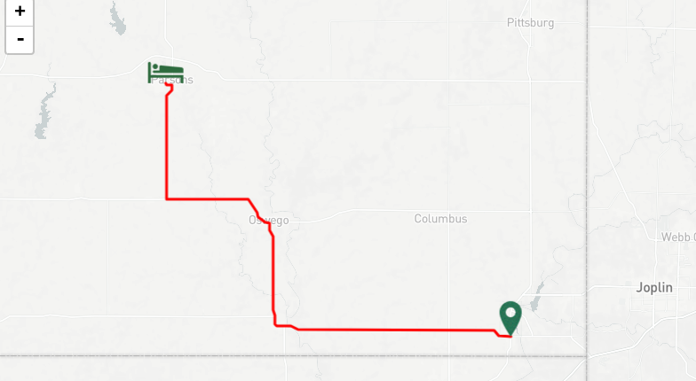
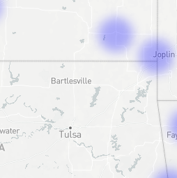
On the green book maps I typed in Baxter springs Kansas as my starting point and Tulsa Oklahoma as the end. I saw that there were no stops along the way that were considered “safe” stops. In the heat map view of the same location there was only some faint blue places but none on my path. I was not shocked to see this because I know that the south was more racist at the time.  I can really see now how “Digital mapping and database construction can allow us to reconstruct, preserve, and visualize vestiges of the past”. I knew the south was a hard place to live and travel for people of color but seeing it laid out on a map and knowing they would have to travel for thousands of miles with no safe place to stop is eye opening. I think seeing it mapped out like this can make a person understand it more. Comparing the Green Book maps to my first map , I can conclude that all of the neat tourism stops were only for white people. People of color would not get to safely experience any of these back then. I think this is interesting because the American Guide series were written to  “convey the “true” America to its people “ and I feel in a way it did but comparing the three different maps conveys more about true America then the single guide.

Bond, Sarah. Mapping Racism and Assessing the Success of Digital Humanities. October 2017, https://sarahemilybond.com/2017/10/20/mapping-racism-and-assessing-the-success-of-the-digital-humanities/

The American Guide Series: American Culture defined: The American Guide Series. Digital Exhibits. http://exhibits.usu.edu/exhibits/show/americanguideseries/americanguideseries

Mulligan, Shannon. Kansas line to Tulsa OK, November 2019. https://storymap.knightlab.com/edit/?id=kansas-line-to-tulsa-ok

A Guide to the Old Dominion

Trip: https://storymap.knightlab.com/edit/?id=virginia-a-guide-to-the-old-dominion-tour-1

When it comes to mapping out the racial stigma people might have in certain areas, it’s important to point out how Virginia doesn’t even have a heatmap for black people.  This shows that people of color aren’t very welcome in many of any stops during this time.  As discussed in previous reading, this was very important for people of color to know whenever travelling. 10. This, compared to the trip I made, could show that it’s dangerous for people of color to travel throughout Virginia. This shows that the books written about the states, were probably not made for people of color to use.

Mapping and special history can teach us what the past thought about the places we now live in.  For instance, in my tour I chose Virginia, since I live here and am familiar with a lot of the areas the book was talking about.  This way, I can compare what the authors thought about the area back in the 1930s-40s and how I see the world today.  It also gives good examples to how the state worked back then and what areas were important then that aren’t so important now.  Spatial history can tell us where people lived, and how people travelled.  For instance, back when the book was being written, many people travelled by bus instead of their own cars, so there are many stops where the bus would be able to drop people off or pick them up.  It describes where the best tourist areas are as well, so it shows which areas might be considered more interesting for tourists.

By using primary sources, we can get better information about the states that we are travelling though in our research than if it were secondary sources.  We can see exactly what the people were thinking and how they described states.  Also, we can see exactly what they were seeing back when there weren’t many highways or much ease of travel.  This way is better than a secondary source, because instead of getting what a historian thinks happened, or how they think a group of people thought, we can see exactly what the person was going through and how they travelled throughout the United states.

Blog 7

These guidebooks were vital to westward bound travelers as there was little other method of knowing the exact routes or ares that one would travel through. There is no luxury of GPS or tourist guides like we have today which exemplifies the importance of these early forms of automobile guides. These WPA guides for regions of the US cover multiple cities on multiple routes while detailing the regions and cities along such route. Schaffer’s book on these guides details how the guides went through multiple reworkings in order to provide the best detailed tour guide of these regions as possible. The wording and structure of the guides seem to make it targeted toward more wealthy people as tourism was not a big industry during this time period. 11


I learned much about the northern areas of Texas by doing this project. The guide provides details on many of the cities and towns that the routes pass through which give a good feel and scope of the area. These maps can tell us a lot about the history of the areas they cover as well as the rise of tourism in the US. These maps also give us an insight to the racial inequalities of the time as well. When making the project map, I noticed that many of the cited cited racial historical events such as native american lands and white expansion into such lands which shows just some of the racial tensions at the time. After comparing my map to the The Green Book one it revealed even more racial inequalities. The path in the American Guide Series was anything but ideal for black travelers. The Green Book path shows that the nearest hotel for colored people to the destination was literally across two state lines. Sarah Bond’s article on mapping racism also shows the same inequalities. She covered how the spatial mapping of racism at the time shows an extra layer to the treatment that these people felt. It also details the multiple kinds of maps that scholars have been working to show these inequalities. 12 . https://uploads.knightlab.com/storymapjs/496d63689e291ecc46a4a31be0418a47/texas-guide/index.html

Mapping and Spatial History

The automobile tour for Americans in the 1930s was a way to discover their country. Through tourism, they could grasp the notion of nation in new ways. Tourism is a ritual of citizenship and Americans should be thinking in terms of behavior and belief, values and lifestyles, symbols and meanings.13

Migrants brought their traditions with them. The automobile travelers also brought and shared their culture wherever they would go. It was a symbiose where both residents and travelers learned from each other.  The migrants had no choice than learning from those new places and it brought diversity to the West.

The guidebooks reflect the expansion of tourist opportunities and the changing concepts of the nation. They were addressed to all Americans.14

I decided to map the American Guide “California: a guide to the Golden State”. I oriented my research around the theaters in California throughout the guide. The idea was to get a better understanding of which theaters and plays were highlighted by the government in the 1930s.

The Green Book was a travel guide published between 1936 and 1966 that listed hotels, restaurants, bars, gas stations, etc. where black travelers would be welcome.

The photograph below represents a screenshot taken from black travelers’ friendly places between Los Angeles and San Francisco represented by the heatmap view. Some places concentrated in those two cities are similar to the one we can find in the American Guide.

Nevertheless, places in between differ. The places visited by the American Guide are on the coast while the ones from the Green Book are deeper in the lands.

This naturally leads to understand that segregation and racial bias impacted tourism. Indeed, African American would discover a different road trip from what the American Guide would recommend. African American activists used maps and visualizations to understand and explain detrimental effects of slavery in the country.15

With the Green Book and the American Guide mapped, we can also visualize the inequalities related to tourism. African Americans would not get to see the same place, restaurants, bars and much more. These inequalities create a two-face tourism.

Black and white travelers were looking for entertainment and cultural exchange. They wanted to discover their country and see what regions had to offer. Nevertheless, it is obvious that African Americans did not have the chance to enjoy the same itineraries. Tourism was also marked by social inequalities.

Geographic Information Systems (GIS) help to geolocate social justice movements, visualize historical and present racism, and highlight racial issues.

Thanks to StoryMapJS tool, I was able to map the American Guide of California. Mapping some places of the tours helped to come up with a new understanding of the Guide and the life of people at the time. We can click on an area of interest and discover what happened at the time and interact with different kind of sources.

When exploring primary sources spatially, we can better understand their organization and process. As a matter of fact, mapping the American Guide of California helped to visualize the itinerary followed which was determining for the government in the 1930s.

Blog Post 7: The Empire State

While doing this skill assignment, I realized that the American Guide series seemed to focus a lot on the culture and geography of states, instead of really honing in on issues. This statement, however, only really applies to the New York American Guide from 1940 because this is the one that I analyzed and used for my map. For actual research purposes, I would have to read multiple guides from different states to see what those writers and editors chose to emphasize on. No matter what the state, like Marguerite Shaffer quoted in her See America First: Tourism and National Identity, 1888-1940, all guides sought out to attempt to create a “‘literature of collective of self-consciousness, a people’s and a nation’s biography, a story of human and physical geography.’ In both its scope and design, the WPA American Guide series manifested this desire to document and design a unique and indigenous American culture” (Shaffer, 2001, p. 203). 14

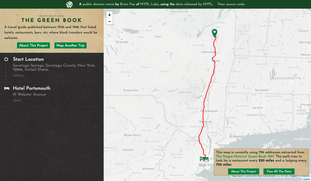
In the “Navigating the Green Book” feature by the New York Public Library, I was really surprised to see so few establishments available for people of color in 1947. I was expecting to see a lot more locations open, especially in the North. While looking at it, I thought to myself about how Victor Green went about receiving information about these different establishments. Perhaps, there were more that catered to Black customers, but Green simply didn’t have that knowledge in 1947. In comparison to the 1956 map, the 1947 one seemed to unfortunately lack, in my opinion, enough places to service Black Americans. Seeing the 1956 map made me consider whether or not establishments were moving towards a more tolerant and progressive business structure and started to allow Black people into their stores, or did Green simply learn more information over the decade. In Sarah Bond’s article, “Mapping Racism and Accessing the Success of the Digital Humanities,” she talks about the fact that “people of color have been using maps to visualize racism for a long time,” including W.E.B DuBois and Booker T. Washington in the late 1800s and early 1900s (Bond, 2017, p. 1). 16 I think the Green Book series in a way is a continuation of this trend set by prominent Black activists to show America how racist and detrimental it is towards people of color.

I chose the American Guide to New York titled, “New York: A Guide to the Empire State.” I mapped out Tour 21, which featured locations starting in Montreal, Quebec, Canada and ending in New York City, NY. What I found from the coverage of most locations was that the writers tended to focus on the geography of these specific places. Information about the state itself was featured in other sections. The Tour barely talked about the present-day, as in 1940 when the guide was written, locations and the people who inhabited them, but rather the locations in a historical context, as well as their relation to highways and local routes. This is a big contrast to the Green Book. The Green Book didn’t feature as many locations and it only strictly focused on culture (restaurants, lodging, etc.) and not history. There’s history to be found in both, though. In looking at these books, it’s easy to decipher treatment of ethnic Americans at the time. At least for the New York American guide, foreign-born, Black, and Native Americans are all spoken about statistically, and if not statistically, then either not at all or simply blown over. However, the Green Book is essentially always radicalized. Although it’s just a map with safe places for Black Americans to stop on their travels, it’s a historical statement over the fact that guides like that existed in general.

css.php